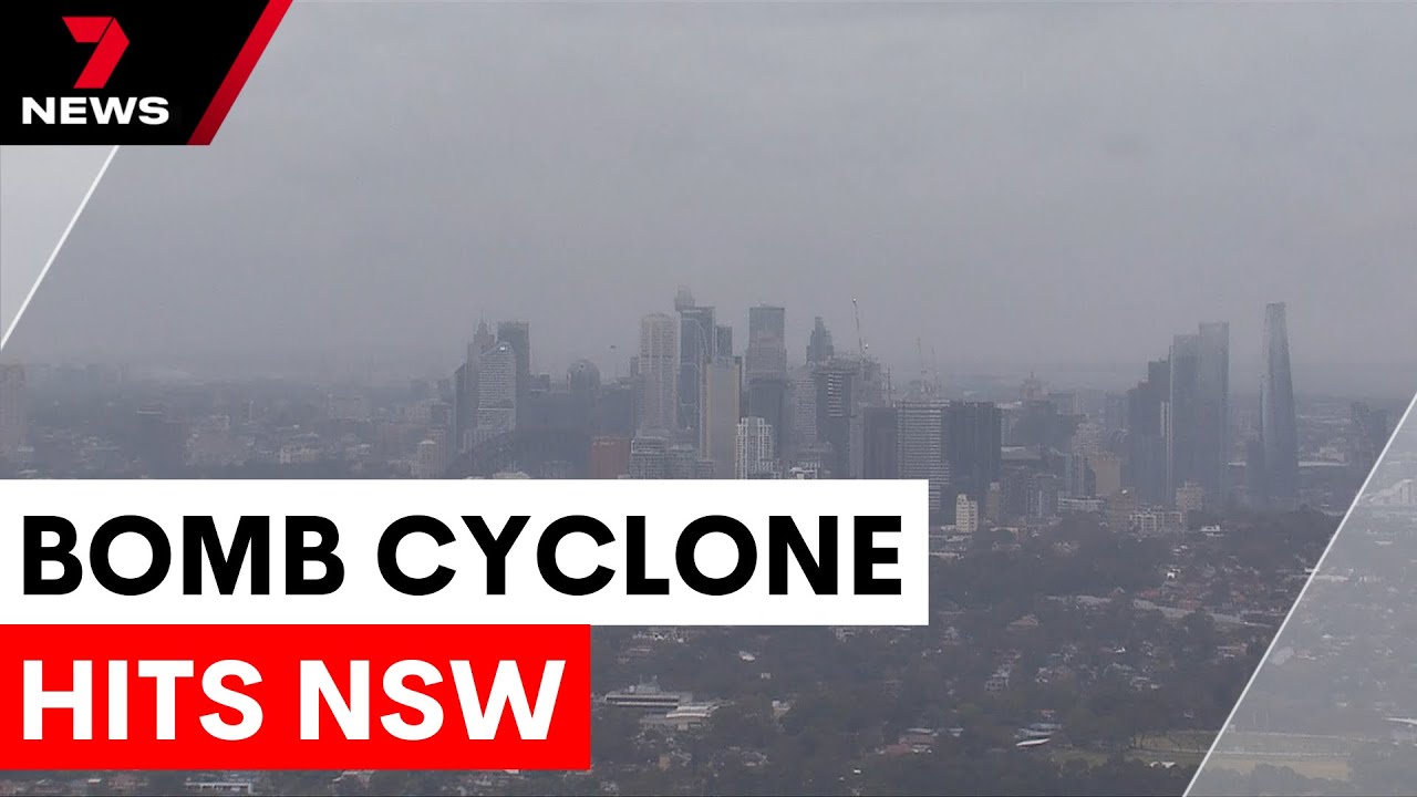
Australia’s east coast is currently facing a severe weather event, with powerful storm systems unleashing damaging winds, heavy rainfall, and a heightened risk of coastal erosion and flooding. This intense weather pattern is being driven by what meteorologists call an East Coast low, a rapidly intensifying low-pressure system sometimes referred to overseas as a 'bomb cyclone.' Here’s a detailed overview of what’s happening, what to expect in the coming days, and the critical warnings residents should heed.
Table of Contents
- The Current Weather Situation
- Warnings and Alerts in Effect
- What to Expect Over the Next Few Days
- How to Stay Prepared
- Frequently Asked Questions
The Current Weather Situation
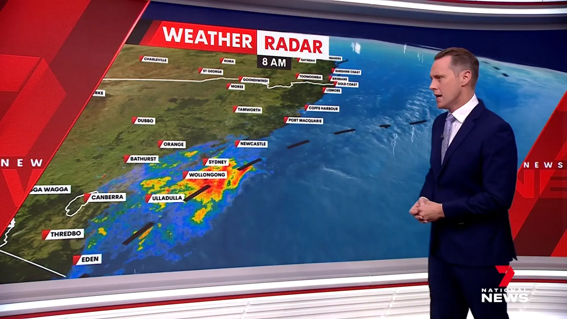
The weather is deteriorating quickly along the New South Wales coast. Rainfall has been significant, with some areas already recording over 100 millimeters in the last 24 hours. This rain is associated with a trough and a low-pressure system undergoing a process known as "bombing" — a rapid intensification that causes the storm to strengthen swiftly.
Locally, this phenomenon is best described as an East Coast low, which is expected to linger near the coast for several days, continuing to impact the region. Winds around this system are forecast to ramp up significantly later today, particularly between Sydney and Newcastle.
Warnings and Alerts in Effect
Multiple warnings have been issued to keep communities informed and safe:
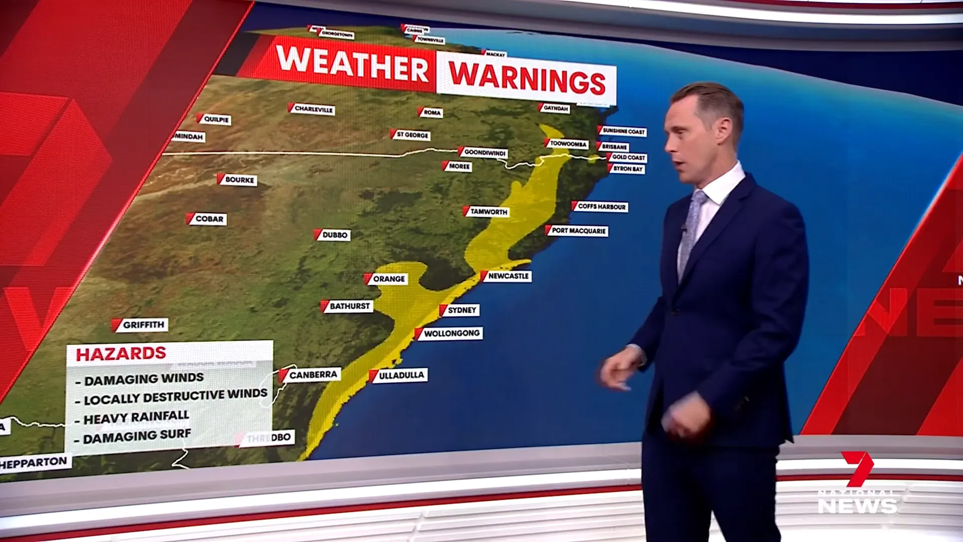
- Damaging Wind Gusts: Winds exceeding 90 km/h are expected along the high ground of New South Wales and even into southern Queensland. These westerly winds are already causing disruption.
- Destructive Gusts: Localised gusts over 125 km/h are possible, which could be strong enough to cause embedded tornadoes. While rare, there is a risk of one or two such events along the southern New South Wales coast, potentially leading to severe wind damage.
- Heavy Rainfall and Flash Flooding: Six-hourly rainfall totals are expected to exceed 120 millimeters, especially from Wollongong southwards to the border. Flash flooding is likely in these areas.
- Coastal Hazards: A separate warning highlights the risk of coastal erosion and damaging surf, with an extra strip of caution along the coast.
Given these multiple hazards, it is crucial for residents to stay vigilant and monitor warnings closely.
What to Expect Over the Next Few Days
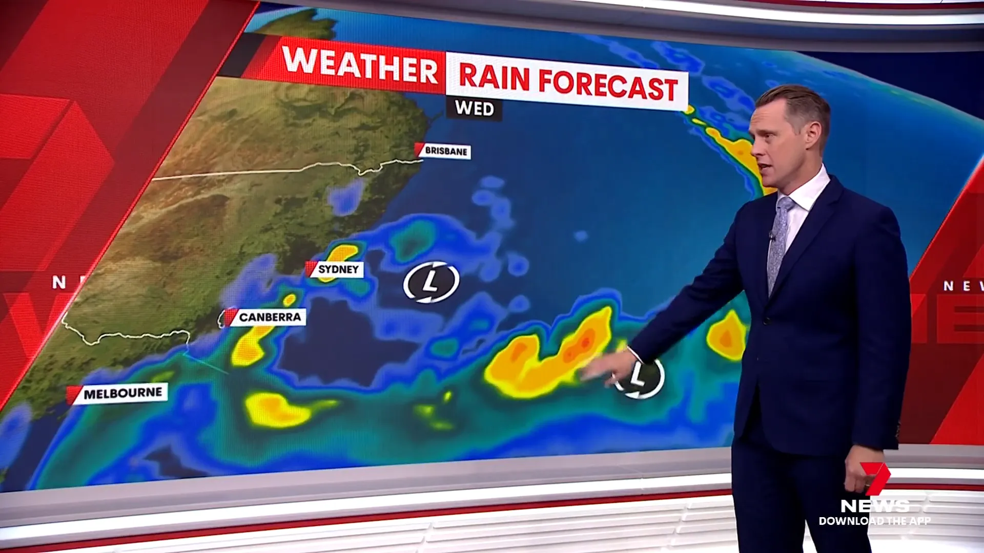
The unsettled weather is not expected to ease anytime soon. The East Coast low near New South Wales will likely remain entrenched for several days. Adding to the complexity, a second low-pressure system is forecast to move down, and the interaction between these two systems will create an erratic weather pattern known as the Fujiwara effect. This phenomenon, often seen with tropical cyclones, causes the two systems to dance around each other, making their movement and impact harder to predict.
Despite the uncertainty in exact paths, we can expect ongoing rough seas, strong winds, and persistent rain. Widespread rainfall totals of 100 to 200 millimeters are anticipated along southern New South Wales and into eastern Victoria.
Currently, flood watches are in place, mostly indicating minor to moderate flooding, but these conditions could worsen if rainfall intensifies further.
How to Stay Prepared
With such a dynamic and potentially dangerous weather event unfolding, here are some key preparedness tips:
- Stay Informed: Regularly check updates from the Bureau of Meteorology and local authorities.
- Plan for Power Outages: Strong winds may disrupt power supplies, so have essentials ready.
- Avoid Flooded Areas: Never attempt to drive or walk through floodwaters.
- Secure Outdoor Items: Loose objects can become dangerous projectiles in high winds.
- Follow Official Warnings: Adhere to any evacuation orders or advice issued by emergency services.
Frequently Asked Questions
What exactly is an East Coast low?
An East Coast low is a type of intense low-pressure system that forms near the eastern coast of Australia. It can bring heavy rain, strong winds, and coastal hazards. While sometimes called a 'bomb cyclone' overseas due to rapid intensification, the term East Coast low is more commonly used locally.
How dangerous are the wind gusts expected during this event?
Damaging wind gusts over 90 km/h are expected, with localized destructive gusts exceeding 125 km/h. These stronger gusts can cause significant damage, including the possibility of embedded tornadoes in a few areas.
What areas are most at risk of flooding?
The greatest flood risk is from Wollongong southwards to the New South Wales-Victoria border, with flash flooding likely due to heavy, persistent rainfall.
What is the Fujiwara effect and how does it affect the weather?
The Fujiwara effect occurs when two nearby low-pressure systems interact, causing them to orbit around each other. This makes their paths more unpredictable and can prolong periods of unsettled weather, as is happening with the two lows currently affecting the east coast.
Where can I get official weather updates?
Stay updated with the Bureau of Meteorology and local emergency services for the latest warnings and advice. It’s important to follow their guidance for your safety.
Stay safe and prepared as this extreme weather event unfolds. For continuous updates and detailed forecasts, keep an eye on trusted meteorological sources and emergency alerts.


