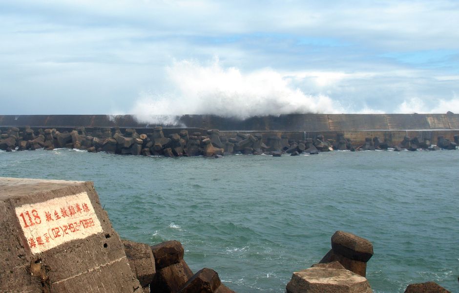
Typhoon Dolphin, the most powerful tropical cyclone to strike China this year, made landfall on Sunday evening near Yuhuan in eastern Zhejiang province, unleashing sustained winds of up to 151 km/h and triggering the evacuation of more than one million people across the region. Thousands of flights were cancelled as authorities scrambled to protect communities along a densely populated stretch of China's eastern coast.
China's National Meteorological Centre confirmed the storm crossed the coastline at approximately 5:30 pm local time, issuing a red typhoon alert — its most severe warning level — and forecasting what it described as "extraordinary torrential rain" in parts of central and eastern Zhejiang.
Mass Evacuations and Emergency Responses Across the Region
The scale of the emergency response reflected the storm's intensity. In the city of Wenzhou, authorities relocated more than 900,000 residents and opened in excess of 1,000 emergency shelters. In neighbouring Taizhou, around 390,000 people were evacuated on Saturday evening alone. Shanghai moved more than 30,000 people from higher-risk areas.
In Fujian province to the south, nearly 99,000 people were evacuated from high-risk zones after authorities raised the typhoon emergency response to Level 3. Zhejiang, Shanghai and Jiangsu also activated Level 3 emergency responses. Offshore workers were brought to safety, vessels were ordered back to port, and checks were stepped up at reservoirs, mountain streams, landslide-prone areas, construction sites and tourist locations.
Fujian maritime authorities suspended 55 coastal passenger ferry routes, halted all 115 offshore construction projects and moved 290 construction vessels to sheltered waters. Shanghai's Yangshan port cleared ships from its berths and relocated more than 500 small and medium-sized vessels ahead of the storm's arrival.
Flights Grounded Across Eastern China
The disruption to air travel was extensive. Nearly 1,400 flights in and out of Shanghai's two main passenger airports were cancelled on Sunday, with a further 270 inbound and outbound services axed at Hangzhou's airport in Zhejiang. In total, flight-tracking data indicated approximately 1,500 cancellations linked to the typhoon in the Shanghai area alone.
Among those stranded was a 42-year-old tourist from Guangdong, surnamed Chen, who had been due to fly home from Shanghai on Sunday. His family was rebooked onto a Monday evening flight, though he said they remained uncertain whether it would depart. Displaying a pragmatic attitude common in typhoon-prone southern China, Chen remarked: "To us Guangdong people, this typhoon is as ordinary as having a meal and feeling the wind. It's just part of everyday life."
Before reaching the Chinese mainland, Dolphin swept over Japan's southern Okinawa prefecture, injuring seven people — including a man aged over 100 who was blown over by gusts and struck his head — and leaving more than 50,000 buildings without power. In Taiwan, dozens of ferry services were suspended and more than 180 flights cancelled as heavy rain and strong winds battered the island's north. In the Philippines, a landslide struck three houses in the mountain resort city of Baguio, with five people rescued and seven reported missing.
Flood and Landslide Risks to Persist for Days
Forecasters warned that the danger would not end with landfall. Heavy rainfall is expected to continue through to at least August 10 across a wide arc taking in Zhejiang, Shanghai, northern Fujian, northeastern Jiangxi, central and southern Anhui, and much of Jiangsu. Parts of central and eastern Zhejiang face the most extreme rainfall totals, with 250 to 500 millimetres forecast for some areas — enough to trigger severe flooding and landslides.
China's water resources ministry identified the Qiantang, Yong, Jiao and Shuiyang rivers as being at risk of major flooding, warning that smaller rivers in the hardest-hit areas could rise above warning levels. Authorities also flagged a high risk of geological disasters in parts of Zhejiang, with residents in red mountain-torrent warning zones urged to comply with local evacuation orders.
After making landfall, Dolphin is expected to track westward before slowing over central and southwestern China and gradually weakening. However, forecasters cautioned that a slower-moving system could prolong heavy rainfall, compounding flood risks — particularly in mountainous terrain and along smaller waterways.
The storm's effects were felt well beyond its immediate path. In Hong Kong, the weather observatory recorded a temperature of 36.9 degrees Celsius — described as a record high — driven by warm air pushed over the city by Dolphin's circulation. The observatory warned that extremely hot conditions would persist through Tuesday as the storm continued to move inland.
Climate Context
Scientists have long warned that global warming is increasing the likelihood and severity of extreme weather events such as tropical cyclones. Dolphin's intensity at landfall — equivalent to a Category 1 hurricane on the Saffir-Simpson scale — underscores the growing threat posed by powerful storms making landfall along China's heavily populated eastern seaboard.