Hurricane Polo has rapidly intensified into one of the most powerful Pacific cyclones in recent memory, churning off Mexico's southwestern coast as a Category 5 storm and threatening communities across several states with dangerous rain, flooding and mudslides — even if the storm itself never makes direct landfall.
The U.S. National Hurricane Centre in Miami described Polo as "extremely dangerous" on Tuesday night, recording maximum sustained winds of 65 km/h extending outward from the eye, with tropical storm-force winds reaching as far as 169 kilometres from the storm's centre.
Where Hurricane Polo Is Headed
In the early hours of Wednesday, Polo was nearly stationary, sitting approximately 325 kilometres south of Zihuatanejo in the state of Guerrero. Forecasters expected the storm to pivot sharply to the northwest during the day before tracking west-northwest over the following days — a trajectory that could spare Mexico's coast from a direct hit but still deliver punishing conditions onshore.
Mexican President Claudia Sheinbaum indicated that experts considered a direct landfall unlikely. Nevertheless, tropical storm conditions were forecast to affect the Pacific coastal states of Guerrero, Michoacán and Colima from Wednesday into Thursday. Mexico's navy moved to shut down ports across both Guerrero and Michoacán, urging fishermen and civilians to exercise extreme caution.
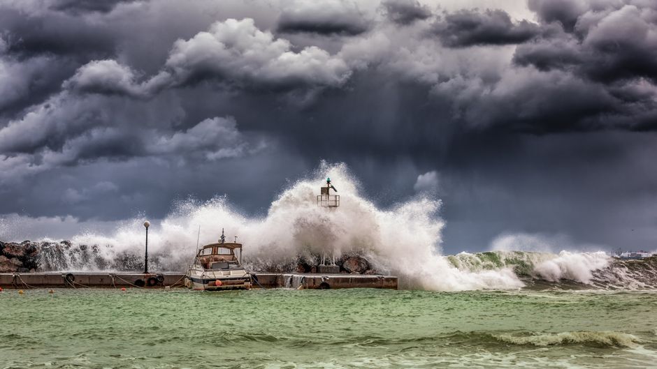
Authorities temporarily suspended school classes in several areas on Tuesday as a precaution, and beaches quickly emptied as dark clouds gathered over choppy, unsettled seas.
Life-Threatening Flooding and Mudslide Risk
Scientists and emergency officials have warned that Polo poses a serious indirect danger even along the sections of coast it does not strike directly. Rainfall totals of 8 to 15 centimetres are expected across Guerrero and Michoacán, with lighter but still significant falls forecast for coastal parts of Oaxaca, Colima and Jalisco.
The U.S. Embassy in Mexico issued a formal weather alert urging American citizens to stay away from beaches and waterways, warning that "even if the storm does not make direct landfall, heavy rain may produce life-threatening flooding and mudslides," and that hazardous ocean conditions could generate deadly rip currents and rogue waves.
In the city of Lázaro Cárdenas in Michoacán, restaurant owner Concepción López Villegas was already watching strong waves batter the coastline as she worked to protect her seaside business. "We're worried and trying to protect our businesses," she said. "And of course, we're sad because it's our heritage, our legacy that from one moment to another could be destroyed."
'Truly Remarkable' Intensification Stuns Scientists
The speed at which Hurricane Polo gained strength left both meteorologists and authorities taken aback. The National Hurricane Centre described Polo's rapid intensification over the preceding 24 hours as "truly remarkable."
Kristen L. Corbosiero, a professor at the University at Albany's Department of Atmospheric and Environmental Sciences, put the storm's ferocity in stark historical terms. "This is one of the strongest storms ever in the Pacific Basin," she said. For comparison, data from the National Hurricane Centre shows Polo's wind speeds are comparable to only a handful of hurricanes in the region across recent decades — most notably Hurricane Patricia in 2015, which produced winds of 346 km/h.
Philip Klotzbach, a research scientist in the Department of Atmospheric Science at Colorado State University, attributed Polo's dramatic strengthening to El Niño — the climatic phenomenon that has driven severe droughts across Mexico and Central America in recent years while triggering floods elsewhere in the region.
Communities on Edge After Years of Powerful Cyclones
The arrival of Hurricane Polo has heightened anxiety along a coastline that has already endured a succession of powerful storms in recent years. The combination of an unusually strong storm, climate-linked intensification, and dense coastal communities means authorities are urging residents not to become complacent simply because a direct landfall appears unlikely.
As forecasters continued to monitor Polo's track, the clearest message from officials on both sides of the border was consistent: the dangers extend well beyond the storm's eye, and communities across Mexico's Pacific coast should remain on high alert throughout the week.